|
| *****SWAAG_ID***** | 995 |
| Date Entered | 22/05/2017 |
| Updated on | 26/05/2017 |
| Recorded by | Tim Laurie |
| Category | Mining Related |
| Record Type | Industrial Archaeology |
| Site Access | Public Access Land |
| Record Date | 21/05/2017 |
| Location | Teesdale, Lunedale, |
| Civil Parish | Lunedale |
| Brit. National Grid | NY 84 20 |
| Altitude | 365m-405m |
| Geology | Mineralised and faulted zone of the Great or Main limestone in the vicinity of the Lunedale Fault. |
| Record Name | A recent visit to the Lunehead Lead and Baryte Mine complex. |
| Record Description | The Lunehead Lead and Baryte Mine comprises widespread visible workings of different periods and was was the most productive mine operated by The London Lead Mine Company in Teesdale. This very extensive mine complex complex extends from river level at Lunehead Gill Beck up to and including the hushes and shafts on the outcrop of the Great Limestone on open moorland south of the B6277 road includes extensive open cut hushes and very many shafts together with a crushing mill and two mine shop buildings.
|
| Dimensions | See photos |
| Additional Notes | This mine was worked in living memory (1937) by miners who walked with their 'Bait' up to the mine each Monday morning from Brough. The miners lived in the Mine Shop Buildings (see photos) from Monday to Friday, returning to Brough on Friday evening.
For the following and further detailed description of this mine together complex with statistics of the lead and barytese ore produced between 1771 and 1984, see http://portal.ariadne-infrastructure.eu/page/14791324
Worked by London Lead Co. from 1771 to 1880 into Wensley, Read, Nacky (Old Sun), White, Little White, Cavern, Lunehead No.1 and Hunter Veins. Between 1843 and 1879 produced bulk of LLCo.'s Yorkshire mines lead concentrates c2369 tons (2) From 1884 produced Barytes - 1884 to 1913 , 35807 ton Total to 1981 estimated at 70,00 tons (surely 70,000 tons,TCL) (3) Worked by Reynoldson of Brough for barytes from 1884 -1937. From 1939 - 1981 by Athole G Allan of Stockton. Site includes Crushing Mill, two reservoirs, aqueduct, with tramways and a mine shop |
| Image 1 ID | 7341 Click image to enlarge |
| Image 1 Description | The two mine shop buildings, dormatories for the miners who worked here until 1937. | 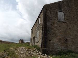 |
| Image 2 ID | 7343 Click image to enlarge |
| Image 2 Description | | 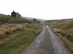 |
| Image 3 ID | 7344 Click image to enlarge |
| Image 3 Description | Small packhorse bridge on the old road to the mine | 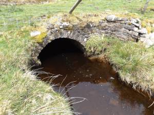 |
| Image 4 ID | 7345 Click image to enlarge |
| Image 4 Description | Mossy saxifrage on the bridge abutment | 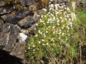 |
| Image 5 ID | 7346 Click image to enlarge |
| Image 5 Description | The remains of the crushing mill | 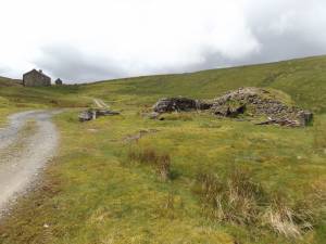 |
| Image 6 ID | 7348 Click image to enlarge |
| Image 6 Description | Large mine shfts and open cut trenches on the | 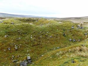 |
| Image 7 ID | 7349 Click image to enlarge |
| Image 7 Description | Open cut hushes with the limestone walls of the emptied vein visible | 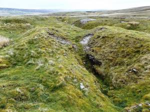 |
| Image 8 ID | 7350 Click image to enlarge |
| Image 8 Description | Open cut hushes with the limestone walls of the emptied vein visible | 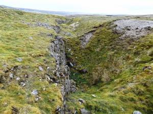 |
| Image 9 ID | 7353 Click image to enlarge |
| Image 9 Description | Open cut hushes with the limestone walls of the emptied vein visible | 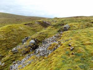 |
| Image 10 ID | 7354 Click image to enlarge |
| Image 10 Description | Open cut hushes with the limestone walls of the emptied vein visible | 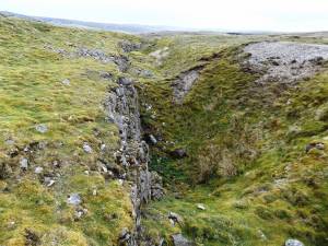 |
| Image 11 ID | 7351 Click image to enlarge |
| Image 11 Description | One of the many ore dressing floors on the hushes | 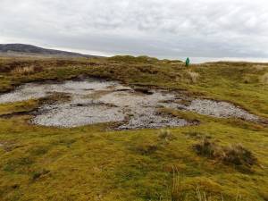 |


